


The North Sea island of Spiekeroog is a huge natural laboratory: A team of researchers led by Gudrun Massmann and Luise Giani has studied how its eastern part, the “Ostplate”, has been transformed from a small sand flat into a vast, wild landscape of sand dunes and salt marshes.
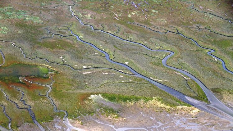
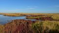
The great wilderness begins behind the National Park Centre Wittbülten. The red brick building, where visitors can learn about the flora and fauna of the Wadden Sea, roughly indicates the point where the island of Spiekeroog used to end around 1950. At that time, there was nothing but a few small white heaps of sand – and behind them, a bare, dry sand flat and the sea stretching all the way to the horizon. Nowadays you can walk eastwards from the National Park Centre for hours on solid ground. Behind the building a trail begins that winds its way between a chain of dunes and flat salt marshes crisscrossed by tidal creeks for about seven kilometres, until it reaches the end of the island.
The inconspicuous path, which visitors are only allowed to use during the winter months because of the numerous birds breeding here in spring, leads through one of the most untouched landscapes in Germany – the ”Ostplate” or eastern flat of Spiekeroog Island. The new part of the island, like the rest of the East Frisian Islands, has been a protected area since 1971. Since 1986, when the Wadden Sea National Park of Lower Saxony was established, it has been part of the most strictly protected restricted zone. ”There are no coastal management measures of any kind, no construction. The landscape is just left to itself – it’s the jewel of the national park,” enthuses Prof. Dr. Gudrun Massmann, head of the Hydrogeology and Landscape Hydrology working group at the University of Oldenburg. The only forces at work here are the tides, the wind and the weather. Storm tides repeatedly break through the young dunes, depositing new sand and flushing salt water into the gaps between them.
A unique natural laboratory
All this makes the Ostplate a unique experimental laboratory: ”You can literally watch how the landscape evolves, how the dunes grow higher and higher and the vegetation changes,” explains Prof. Dr. Luise Giani, who heads the Soil Science working group at the university. Less visible are the changes below the surface, which are crucial to turning the former sand flat into a piece of new land. Here, various chemical reactions occur, substances redistribute, and rainwater seeps into the dunes, displacing the saline groundwater and creating contiguous bodies of freshwater.
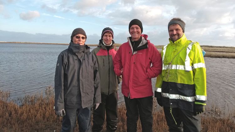
It was these processes that Massmann, Giani and Dr. Thomas Pollmann, Dr. Tobias Holt and Dr. Stephan Seibert, who were still doing their PhDs at the time, rigorously studied from 2015 to 2019. Their project, funded by the German Research Foundation (DFG), was titled ”Chronosequential initial evolution of soils and freshwater resources of a barrier island.”
Accelerated growth
The history of the Ostplate began at the end of the nineteenth century when the last remnants of what was once the Harlebucht (Harle Bay) were diked. Originally fifteen kilometres wide, in the sixteenth century the bay stretched about ten kilometres inland, almost all the way to what is now the city of Jever. ”The flow patterns in the tidal flats changed so much as a result of the diking that sand accumulated east of Spiekeroog at a breath-taking pace,” explains Massmann. Around 1920 a sandflat appeared at the eastern end of the island, the first dunes began to grow on it 60 years ago, and 30 years later a seven-kilometre chain of dunes covered with marram grass and a wide strip of flat salt marshes had formed.
The focus of the hydrological project part was freshwater. A special feature of the East Frisian islands is that despite their small size they have their own freshwater reservoirs, so-called freshwater lenses, which are fed by rainwater and float above denser saline groundwater. The lens in the western part of Spiekeroog, for example, is almost 50 metres thick and supplies residents and tourists with drinking water. But until now very little was known about how and at what speed these bodies of water are formed, how large they are, what determines their chemical composition and what role the soil plays in this process. ”The Ostplate is the only place where it is possible to study the initial stages of freshwater-lens formation,” says Massmann, even if there are no plans to extract water there.
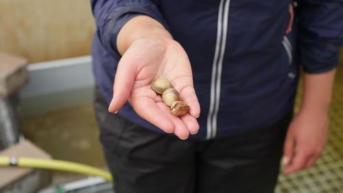
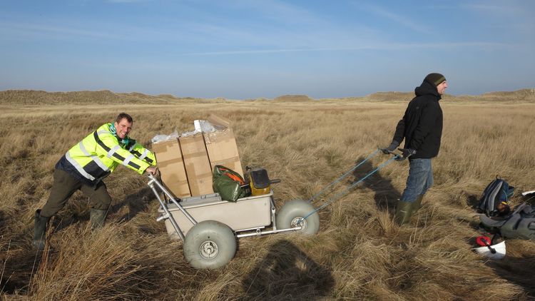
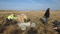
The team had to make regular visits to Spiekeroog to conduct their investigations. The researchers took hundreds of soil and water samples over the course of a year, installing fifteen new groundwater measuring points with built-in data loggers. The instruments still continually record water levels and salinity all the way down to a depth of fifteen metres today. ”The sampling was of course carried out in close consultation with the National Park administration and the rangers; we had to comply with strict regulations,” emphasises Giani.
A transitional area between land and sea
Working in the nature reserve was a unique experience for everyone: ”The Ostplate is a world of its own,” says Pollmann. The team was under constant time pressure during the long marches to the measuring points because the salt marshes are partially flooded at high tide. The researchers also had to transport their equipment – spades, drilling rigs, cameras, pumps and measuring devices, etc. – on foot, and also carry the samples they had collected in their backpacks. It was not unusual for each of them to be carrying twenty kilograms or more at a time.
The data they collected on the new part of the island (and also on the old part for comparison) revealed that the Ostplate is still a transitional area between land and sea that is shaped by tides and storm surges. Holt's measurements and models showed, for example, that although several separate freshwater lenses already exist beneath the dunes of the Ostplate, the formation of which probably began around 1975, they differ from the large lens in the western part of the island: ”These freshwater lenses are only two to four metres thick, much thinner than the one in the west,” Holt explains.
His models also predicted that under the current circumstances they are unlikely to expand any time soon. ”They have already reached the maximum possible size and are in a kind of equilibrium,” the researcher explains. Although precipitation fills up the freshwater lenses, the winter storm tides limit their growth: seawater regularly seeps into the subsoil north and south of the dunes, causing fresh groundwater to become saline and lenses to shrink again. In this way, the lenses grow and shrink in a seasonal rhythm. Only if the dunes of the Ostplate continue to grow, giving rise, for example, to another chain of dunes, could the lenses increase in size.
The rainwater's fate
Using samples from the groundwater measuring points on the Ostplate and from wells in the western part of the island, Seibert studied the chemical processes that occur as the rainwater passes through the dunes, as well as inside the freshwater lenses themselves. His measurements show how the chemical composition of the groundwater changes as it ages. For example, microbes break down organic material with the help of reactive substances such as oxygen, nitrate or sulphate, creating new compounds such as the iron mineral pyrite. ”The oldest water in the main lens in western Spiekeroog is about 50 years old,” explains Seibert.
The smaller lenses on the Ostplate proved to be much younger and more dynamic by comparison. The water there was no more than five years old. The team also found that, unlike in textbook illustrations, fresh and salt water are not clearly separated there but that instead there is a broad transition zone: ”It is here that oxygen-rich, salty seawater meets freshwater that contains no oxygen or nitrate, but does contain dissolved iron, for example. Some minerals precipitate, others dissolve,” Seibert explains.
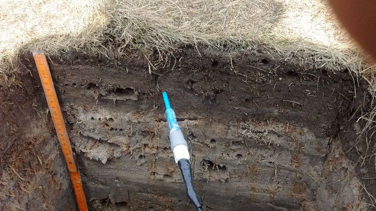
Chemical reactions also take place in the soil above the groundwater. Pollmann's measurements showed that, contrary to expectations, soils in the new part of the island hardly seem to age at all: the dunes and salt marshes in the western part of the Ostplate were formed earlier than those further to the east, but from a pedological viewpoint they are at the same stage of development. ”Tides, wind and storm tides are currently working against soil formation, they keep the soil in a young state”, the researcher explains.
Danger from storm tides
As the project results show, the Ostplate is still a dynamic landscape which, in the absence of coastal protection measures, is constantly changing. But how will the East Frisian Islands develop in the future if the sea level continues to rise and heavy storm tides become more frequent? As part of a newly initiated joint project, the Oldenburg hydrogeology team wants to determine how climate change will affect freshwater lenses – and how these resources, which are so important for the islanders, can be managed sustainably.
”Storm tides that break through protective dunes would be particularly problematic,” Gudrun Massmann explains. ”If they cause seawater to seep from above into a freshwater lens that is used to supply drinking water, this resource could be rendered useless for decades.” The balance between precipitation, water extraction and submarine groundwater discharge is ”unstable and in the worst case irretrievable” – as on Langeoog, where several storm tides in the eighteenth and nineteenth centuries divided the island and its freshwater lens. The lens has not recovered to this day and is still divided into two separate water bodies.
This article was first published in the current issue of the research magazine EINBLICKE.