Activities
Activities
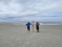
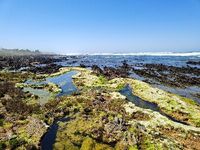
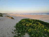
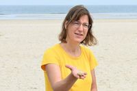
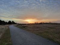
The following movie gives an impression on field work conducted on the beach of Spiekeroog and other coastal sites within previous related projects such as BIME that prepared us for the planned field-work in DynaDeep. The Spiekeroog coastal observatory also serves as a living lab for teaching within the study programmes of the University of Oldenburg. Note that the beach research was carried out by members of the DynaDeep team together with colleagues and partners.
Project activities
In the following you will find impressions of different activities in DynaDeep. Short reports from field campaigns, field work and project meetings provide an overview of the current status and progress of the project.
05/2025: Podcast - Research 24 m below the beach
In the ‘Natürlich Spiekeroog’ podcast, scientist Dr Jutta Niggemann talks to producer Daniel Wunderer about the DynaDeep project. She provides fascinating insights into the research being carried out on the island and its initial findings.
Do have a listen (in german only) ! #17 – DynaDeep - Natürlich Spiekeroog - Der Podcast von der Grünen Insel
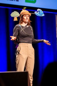
05/2026: Audience award for Meike Freis at the FameLab Science Slam
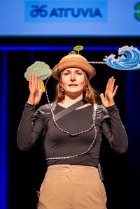
As part of the regional FameLab competition, Meike Freis from the DynaDeep project presented her PhD topic “How beaches breathe” in a three-minute talk without PowerPoint, using only self-provided props, and received the audience award. Congratulations Meike! Her PhD project is part of subproject P2 “Metabolic rates: from heterotrophic to autotrophic processes” and focuses on oxygen consumption rates and biogeochemical processes in high-energy beaches.
Video of the talk: https://youtu.be/2cYlHBw31Kg?si=4w1H23_H-IRH5ZzH
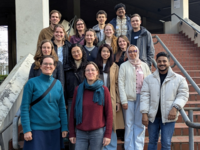
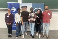
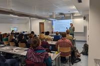
04/2026: First phd-workshop in phase 2
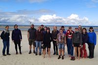
On April 14 and 15, we kicked off the first PhD activity for the new PhD students in DynaDeep Phase II with a symposium on “Fundamentals of the Beach as a Biogeochemical Reactor.” The event brought together 11 PhD students and 6 principal investigators for an engaging exchange of ideas. Mornings featured lectures covering fundamental concepts across disciplines spanning from hydrogeology, (bio)geochemistry to microbiology, integrating both data and modeling approaches. In the afternoons, PhD students presented in groups major findings of the first project phase based on publications. The symposium was an inspiring opportunity to see motivated researchers from diverse fields collaborate closely. It fostered a strong interdisciplinary understanding of beaches as biogeochemical systems and provided an excellent foundation for future collaboration across subprojects.
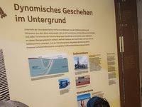
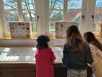
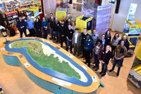
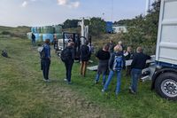
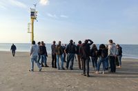
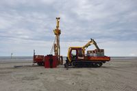
03/2026: Exhibition opening in Wittbülten (Spiekeroog)
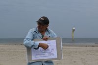
On the last weekend in March, the new exhibition at the Nationalparkhaus on Spiekeroog opened succesfully. Under the theme ‘Life in the Wadden Sea World Heritage Site – experience, explore, shape’, numerous visitors took the opportunity to learn about the various coastal habitats – the sea, beach, dunes, salt marshes and mudflats. The DynaDeep project is also part of the exhibition and provides information about its own beach research. Our technicien Kai presented the direct push device and eplained the deep beach measurements carried out on Spiekeroog. We congratulate the team at the National Park House on a successful opening and wish all visitors much enjoyment as they explore the exhibition.


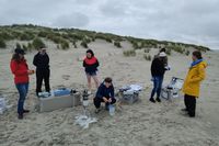
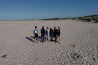
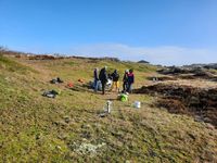
02/2026: New phd students start with field work
The first phd students from phase 2 have started and were successfully working on Spiekeroog already. In February, Leonie (P1), Shristi (P4) and Sarah (P3) have sampled the groundwater wells and installed lysimeters above the high-water line to estimate the volume seawater infiltrating during storm flood events.
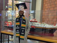
12/2025: Thesis defence successfully completed by Grace Abarike
The DynaDeep-Team congratulates our doctoral researcher Grace Abarike on the successful completion of her PhD. On 18 December 2025, Grace successfully defended her dissertation entitled “Dissolved Organic Matter and Its Interactions with Microbial Communities in the Deep Subterranean Estuary of Sandy High-Energy Beaches”. She conducted her research at the Institute for Chemistry and Biology of the Marine Environment (ICBM) in Oldenburg in the Marine Geochemistry working group under the supervision of Dr Jutta Niggemann and Prof. Dr Thorsten Dittmar.
We thank Grace for her outstanding contributions to the project, both professionally and personally, and wish her all the best for the future.

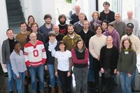
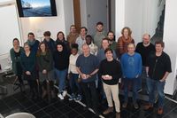
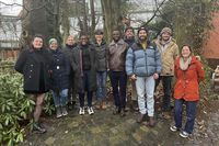
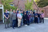
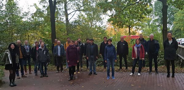
12/2025: Kickoff-Phase 2
On 17 December, new and old members of the DynaDeep team met at the Schlaues Haus (Oldenburg) to kick off phase 2. In a relaxed atmosphere, the members had the opportunity to get to know each other and start planning the new year. We would like to thank all participants for the exchange and discussion!
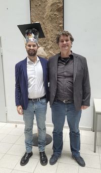
11/2025: Succesful disputation from Kojo Amoako
… we can celebrate again: The DynaDeep team congratulates our doctoral researcher Kojo Amoako on the successful completion of his PhD. On 10 November 2025, Kojo defended his dissertation entitled “Dissolved organic matter in subterranean estuaries: sources and abiotic processing”.
Since 2022, he has been conducting research at the Institute for Chemistry and Biology of the Marine Environment (ICBM) in Oldenburg in the working group for Marine Geochemistry under the supervision of Prof. Dr. Thorsten Dittmar and Dr. Hannelore Waska.
We sincerely thank Kojo for his great contributions to the project and wish him every success in his future career.
10/2025: “SSLiME”-colloqium in South Africa
On 27.10.2025 the “SSLiME”-colloqium took plave at the Ocean Science Campus of the Nelson Mandela University in Port Elisabeth, South Africa. SSLiME are „Supratidal Spring-fed Living Microbalite Ecosystems”, living microbial mats that create their own pools in the supratidal along the hardrock coast of South Africa by calcite precipitation. These unique ecosystems at the land-sea interface rely on very special environmental conditions. At the colloquium, Gudrun Massmann presented DynaDeep und discussed analogys between subterranean estuaries and SSLiME systems with the south african colleaques.

08/2025: Successful thesis defence by Felix Auer
The entire DynaDeep team congratulates our doctoral researcher Felix Auer on the successful completion of his PhD. On 28 August 2025, Felix defended his dissertation at the University of Bremen, entitled “Oxygen Dynamics and Organic Carbon Remineralisation in the Sands of High-Energy Beaches”.
Since September 2021, he has been conducting research at the Alfred Wegener Institute (AWI) in Bremerhaven on biogeochemical processes in shallow intertidal sediments – combining fieldwork, laboratory experiments, and numerical modelling. Many of his exciting results have already been already published in peer-reviewed journals.
We sincerely thank Felix for his valuable contributions to the project and wish him every success in his future scientific career.
07/2025: Second Phase of DynaDeep officially approved
It's official: DynaDeep will have its second phase starting on 15 July 2025.
The DFG published the result of the successful review on Spiekeroog from March 2025 in a press release. Further information on the planned second phase can be found in the press release from the University of Oldenburg. We look forward to four more years of joint beach research!
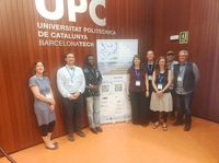
06/2025: Salt Water Intrusion Meeting 2025
This year's Salt Water Intrusion Meeting 2025 took place in June 2–6, 2025, in Barcelona, Catalunya. The DynaDeep project was represented with a series of interesting presentations (oral and poster) in which results from the various subprojects were presented to a broad scientific audience:
Rena Meyer (P1): „Groundwater Age and Mixing Patterns in the Deep Subsurface of a High-Energy Beach” - oral
Kojo Amoako (P3): „Dissolved organic matter mobility and retention in a High-energy subterranean estuary” - oral
Hannelore Waska (P3): "Comparing the Effects of Sea- and Rainwater on the Release of Dissolved Organic Matter and Nutrients from Beach Wrack” - poster
Anja Reckhardt (P4): „Redox-sensitive trace metal mobility in the deep subsurface of a high-energy beach” - oral
Janek Greskowiak (P6): „Simulation of hydrobiogeochemical processes within the subterranean estuary at a real high-energy beach” - oral
- Gudrun Massmann (P1, PZ): Aquifer salinization (I): processes and environments - session chair
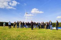
04/2025: DynaDeep at the Staff Training Day of the National Park Houses
On April 28, 2025, a staff training day for the National Park Houses of Norddeich, Norderney and Juist took place at the Seal Centre Norddeich. Approximately 20 staff members met under the heading "Insights into Research". The afternoon programme was dedicated to DynaDeep. In an introductory lecture, Dr. Jutta Niggemann (P3 sub-project) presented the fundamental research questions, methodological approaches and the DynaDeep Observatory on Spiekeroog, and answered many interested questions. Afterwards, all participants went to the Norddeich beach section, where Dr. Niggemann demonstrated the sampling and analysis of pore water. On beautiful spring weather, this was a welcome addition to the programme.

04/2025: Invited talk of Prof. Dr. Clare Robinson at the ICBM
On 24 April 2025, Prof. Dr Clare Robinson (Western University, Ontario, Canada) followed the invitation of DynaDeep spokesperson Gudrun Massmann and presented parts of her work in the ICBM colloquium in Oldenburg. Some members of the DynaDeep-team also used this opportunity to discuss their current research with her. Many thanks for the exciting insights!
„Impact of oceanic forcing on coastal groundwater dynamics and chemical discharge to the sea”
Sustainable management of coastal surface water and groundwater resources is a majorenvironmental challenge due to increasing anthropogenic and climate stressors on coastal areas. Understanding groundwater-ocean interactions is critical for effective management of coastal water resources. From a marine perspective, chemical inputs to coastal seas via groundwater discharge can considerably impact coastal chemical budgets and impair water quality. From a terrestrial perspective, these interactions impact the quality of fresh groundwater resources by influencing salinization and associated mobilization of chemicals in coastal aquifers. Oceanic forcing (e.g., tides and waves) complicate groundwater-coastal water interactions as these forcing drive large quantities of coastal water to recirculate across the groundwater-ocean interface, and alter groundwater flows, salinization and geochemical conditions in coastal aquifers. Further, these forcings intensify mixing and reactions in the subterranean estuary and this in turn controls chemical loading to the ocean. This presentation will provide an overview of recent advances from my research team in understanding dynamic groundwater-ocean interactions including their impact on contaminants including arsenic and fecal bacteria. Finally, the presentation will also discuss the need to develop typologies for subterranean estuaries to enable interpolation and extrapolation of information between site-specific field studies, and to identify strategic data gaps. (Host: Prof. Dr. Gudrun Massmann)
03/2025: International Review Panel on Spiekeroog
From 19-21 March 2025, the official review panel took place on Spiekeroog. Five international reviewers and representatives of the DFG were informed about the current research results in a presentation across all projects and subsequent poster session. They also had the opportunity to take a look at the beach observatory on site. Many thanks to the staff of the „Nationalparkhaus Wittbülten” and the youth hostel for their support in organising the event.
02/2025: Maintenance work at the pole
The strong morphodynamic of a high-energy beach can currently be observed quite well at the pole. While it was installed in the water at the project start, the sandbank has shifted since then and some parts have fallen dry. This requires additional maintenance work by our technicians Kai and Dietmar.


12/2024: DynaDeep-Invited talk at AGU2024 in Washington
DynaDeep spokesperson Gudrun Massmann was invited by the conveners of the session "groundwater-surface water interactions across multiple hydrologic settings" to present the DynaDeep research unit to an international audience at the AGU24. She opened the large session on the 11th of December in Washington with a talk entitled: "Insights on groundwater flow, transport and reactions at a high-energy beach aquifer (Spiekeroog, Germany)", which resulted in interesting discussion with coastal researchers afterwards.
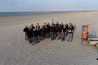
11/2024: DynaDeep PhD Workshop
All seven DynaDeep PhD students met in Neuharlingersiel to work on their publications. The workshop was lead by Jutta Niggemann: “It is a pleasure to experience how our DynaDeep PhD students function as a group. They always keep a focused and supportive working atmosphere for all.”

10/2024: First time visit of the new FWJlers
Since September 2024, Qendresa (Marine Geochemistry Group), Van Anh (Hydrogeology and Landscape Hydrology Group) and Kora (Marine Isotope Geochemistry Group) support the DynaDeep project in the lab and field as part of their voluntary scientific year ("Bundesfreiwilligendienst", FWJ). In October, they sampled the permanent observation wells on Spiekeroog for the first time.

09/2024: Teaching course on Spiekeroog
Students from the Master programs Landscape Ecology and Marine Environmental Sciences of Oldenburg University took advantage of the DynaDeep Observatory to gain knowledge on hydraulic and biogeochemical processes in beach aquifers as part of a practical course from 16.9-18.08.2024. Three sunny days were spend at the beach where hydraulic tests were conducted and groundwater wells and sea water sampled for laboratory analysis. Samples were subsequently analysed in Oldenburg and all results presented in a successful seminar.
09/2024: PhD status seminar
At the beginning of September, the phds from the different sub-projects had the opportunity to present their current research results and exchange ideas with the experienced PIs and postdocs across all projects. In particular, the publication of the collected data was discussed. Many thanks to all participants for the exciting insights.
09/2024: Writing Retreat in Rastede
In preparation for the next DynaDeep phase, a writing retreat took place from 4th to 5th September in the 'Evangelisches Bildungshaus Rastede’. Latest research results were discussed and merged within the subgroups. Many thanks to all participants for the scientific exchange and to the team from the 'Evangelisches Bildungshaus' for the pleasent stay.


09/2024: ARTE DOCU: Beaches in Europe
ARTE has released a documentary about beaches in Europe:
It shows our PhD student Jairo Cueto (P1) and his drone on Spiekeroog (from 14:40). There will be a longer version in the ARTE media library at a later date, which will include videos of other DynaDeep members on the beach. Information will be announced here.
09/2024:50 years, 50 people ( Anniversary Uni Oldenburg )
The university is presenting a university member every week for a year to celebrate its 50th birthday. Magali Roberts, who is working on her PhD-thesis as part of the DynaDeep project, also took part.
08/2024: 7. PhD Day in WHV
At the end of August, the 7th ICBM PhD Day took place in Wilhelmshaven under the motto ‘Transparency in Science and Research’. Some PhD students from the DynaDeep project presented their current work and the ongoing research of their working groups.
uol.de/icbm/meer/nachwuchs/veranstaltungen/doktorandinnentage/7-doktorandinnen-tag-2024
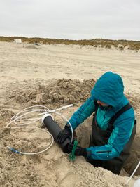
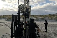
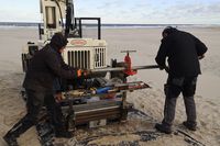
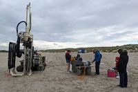
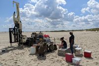
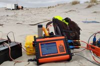
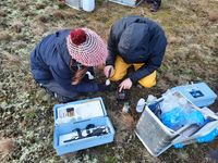
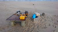
07/2024: Recurring field campaign
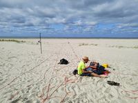
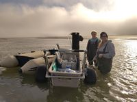
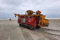
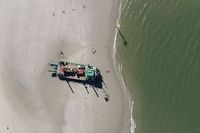
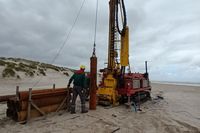
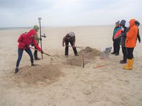
The permanent observation wells at the northern beach of Spiekeroog are sampled every six to twelve weeks. At the same time, a direct push device enables pore water sampling down to a depth of approx. 20 m below the beach surface. Topographical changes are also determined frequently using a diff. GPS or a drone. Geophysical measurements provide information about the salinity distribution in the subsurface. In July 2024, parts of the DynaDeep team travelled to Spiekeroog for the 31st (!) time to continue their field investigations at the northern beach.
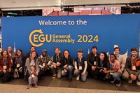
04/2024: EGU General Assembly 2024
This year's EGU General Assembly took place in Vienna from April 14-19, 2024. The DynaDeep project was represented with a series of interesting presentations in which results from the various subprojects were presented to a broad scientific audience:
- Grace Abarike (P3): „Different dissolved organic matter (DOM) sources sustain microbial life in beach subterranean estuary” (oral)
- Kojo Amoako (P3): „The sandy beach subterranean estuary as a potential organic carbon sink” (oral)
- Felix Auer (P2): „Oxycline Variabilities in Intertidal Beach Aquifers Under Seasonally Variable Oxygen Consumption and Physical Forcing Regimes” (oral)
- Janek Greskowiak (P6): „An attempt to calibrate a density-dependent groundwater flow model for a high energy subterranean estuary using particle swarm optimization and integrating salinity-, temperature- and 3H/He age observations” (poster)
- Rena Meyer (P1): „Groundwater travel time distribution in the subsurface of a high energy beach – a multi tracer approach” (poster)
- Anja Reckhardt (P4): „Spatio-temporal dynamics of groundwater biogeochemistry in the deep subsurface of high-energy beaches” (oral)
- Magali Roberts (P4): „Rare earth element dynamics in the deep subsurface of a high energy beach in the North Sea” (poster)
- Stephan L. Seibert (P6): „Reactive transport modeling to study the impact of mineral reactions and surface complexation on the transport of dissolved species in a subterranean estuary” (oral)
- Nico Skibbe (P1): „Investigating spatio-temporal salinity dynamics in coastal aquifers” (oral)
- Hannelore Waska (P3): „Experimental comparison of dissolved organic matter and nutrients leached from beach wrack by sea- and rainwater: A nutritional boost for the sandy beach subterranean estuary” (poster)
Most of the talks were presented in the session "HS8.1.8 - Integrating understanding across the land-ocean continuum: multidisciplinary approaches to studying saltwater intrusion and submarine groundwater discharge", which was co-organized and co-chaired by Rena Meyer, subproject P1. Our project spokesperson Gudrun Massmann, subproject P1 and PZ, was also invited to this session to present the overall project DynaDeep in the keynote "The dynamic deep subsurface of high-energy beaches". Jutta Niggemann, subproject P3, also co-organized and co-chaired the session "BG1.10 Molecular and Isotopic Tracers across Environmental Interfaces: The Carbon Cycle, Pyrogenic and Natural Organic Matter".
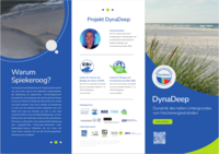
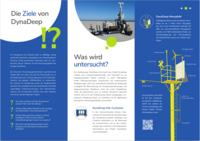
04/2024: Release DynaDeep-Flyer
The new DynaDeep flyer went to print on 18/04/2024. The flyer outlines the DynaDeep project and is intended to draw the attention of and inform both tourists and islanders about the DynaDeep project. The flyer will soon be available at many tourist facilities on Spiekeroog.
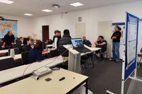
02/2024: 4. Status seminar
The fourth DynaDeep status seminar took place at the Hanse-Wissenschaftskolleg in Delmenhorst from February 26-28, 2024, with the participation of all sub-projects.
The first day of the seminar was primarily used to discuss the preliminary results of the different sub-projects. On the second day of the seminar, the new team members and cooperation partners Julius Degenhardt, Nele Grünenbaum, Martin Könneke and Nils Moosdorf introduced themselves and gave interesting insights into their previous research. In the late afternoon of the second seminar day, the results of a column experiment and the multidisciplinary investigations on the core sediments drilled from the Spiekeroog beach were discussed in smaller groups. The third and final day of the seminar was used intensively to prepare for the next phase of the DynaDeep project. Many thanks to the team of the Hanse-Wissenschaftskolleg, whose optimal organization and support contributed to the success of the fourth DynaDeep status seminar.
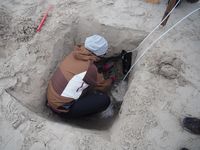
11/2023: Sediment sampling campaign
In the last week of November, the DynaDeep team was on Spiekeroog to take sediment samples from the subsurface. Despite the wintry weather, including snowfall, four sediment cores were successfully taken near the high-water line and close to the dunes at different depths (up to 10 meters). The sediment samples were then analyzed in the laboratory in Wittbülten by researchers from the Max Planck Institute for Marine Microbiology in Bremen. The aim of these investigations is to gain a better understanding of bacterial metabolism in the subsurface, for example, what substances are used by the microbes and what are the rates of microbial processes involved in the methane, sulphate and nitrogen cycles.
10/2023: TRANSCOAST Graduate School visit
In October 2023 the DFG Baltic TRANSCOAST graduate school visited the DynaDeep field site on Spiekeroog as part of an Autumn School. Internal and associated PhD candidates came to the island to amend the mostly Baltic Sea focussed curriculum with lectures and excursions on tide dominated coastal systems. DynaDeep spokesperson Gudrun Massmann gave a lecture about Subterranean Estuaries and explained the DynaDeep project and infrastructure on site at the beach. More information can be found on the Transcoast webpage.
09/2023: Talk at National Park Hous Wittbülten
On 22/09/2023, PD Dr. Bert Engelen, subproject P5, gave a talk on "Spiekeroog Coastal Observatory: Microbiological investigations on both sides of the island" at the National Park House Wittbülten. The talk dealt with the special importance of bacteria for material cycles in coastal ecosystems, which is an important aspect of the DynaDeep project.
09/2023: DynaDeep Beach Day
On 12/09/2023 the DynaDeep "Beach Day" took place. The aim of the event, which was held directly at the investigation transect, was to inform about the overall project, the different subprojects as well as the infrastructure at the beach of Spiekeroog. Holidaymakers, islanders and other interested parties followed the Beach Day with great interest. Further information can be found here.
09/2023: DynaDeep PhDs host a session at ICYMARE conference
From September 18 to 22, 2023, the International Conference for Young Marine Researchers "ICYMARE" took place at the University of Oldenburg. As part of the conference, DynaDeep PhD students organized a session on physical, biogeochemical and microbiological processes and their interactions in coastal ecosystems. A total of 12 presentations (11 oral and 1 poster) were presented on this topic at the conference. To the delight of the session hosts, research in coastal regions was thus the topic with the most contributions at the conference. In addition to current results from the respective subprojects of the DynaDeep PhD students, the session also presented research on new technology metals, carbon transport and temperature developments in coastal regions.
More information and photos can be found here.
08/2023: 3. Status seminar
The third DynaDeep status seminar took place at the University of Oldenburg from August 29-30, 2023 with the participation of all sub-projects.
The first day of the seminar focused on presentations from the individual sub-projects. Exciting new results were reported and the research aspects to be investigated in the further course of the project were highlighted. On the second day of the seminar, there were lively discussions in small groups as well as in plenary sessions about how joint publications could be designed, which further joint research campaigns are planned and which questions for future research have arised from the ongoing project.
08/2023: Talk at National Park House Wittbülten
On 25/08/2023, 14:30 hours, Kai Schwalfenberg, subproject PZ, gave a talk on the "Spiekeroog Coastal Observatory: Scientific Infrastructure at the Land-Sea Transition Zone" at the National Park House Wittbülten on Spiekeroog. Thematically, the existing research infrastructure on Spiekeroog, which includes that of the DynaDeep project, was presented and its purpose and importance for research explained.
04/2023: ARTE covers DynaDeep project
On 24.04.2023, a film team from ARTE was on Spiekeroog to create a portrait of the Spiekeroog beach as well as the North Sea island as part of the six-part series "Strandgeschichten". DynaDeep's research activities on Spiekeroog were presented in the report by Anja Reckhardt (subproject P4), Simone Brick (subproject P5) and Kai Schwalfenberg (subproject PZ). Anja, Simone and Kai showed the functioning of the drilling device and explained the sampling of the groundwater wells. The broadcast date of the ARTE documentary series has not yet been set, but will be announced here as soon as it is known.
02/2023: 2. Status seminar
From 20-21/02/2023 the second DynaDeep status seminar took place at the Hanse-Wissenschaftskolleg in Delmenhorst with the participation of all subprojects as well as the cooperation partners Prof. Holger Freund and Prof. Michael Böttcher.
During the first seminar day the current results of the different subprojects were presented and discussed. The second seminar day served for the realization of different group works. In small groups the first geochemical field data as well as the salinity measurements of different measuring instruments were intensively discussed. Furthermore, the PhD students exchanged ideas about their projects, and ideas for the next phase of DynaDeep were collected in a separate group work. Also, upcoming special campaigns on Spiekeroog were concretized.
Special thanks go to Dr. Doris Meyerdierks and her colleagues, who realized a successful status seminar at the Hanse-Wissenschaftskolleg.
01/2023: 1. PhD Workshop
On January 31st, 2023, all eight DynaDeep PhD students met at Oldenburg University for a one-day workshop. Supported by the PIs Hannelore Waska and Jutta Niggemann, they dealt with the general concept of subterranean estuaries, its implementation in DynaDeep and in the individual PhD projects.
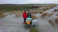
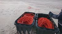
12/2022: First field campaigns
The first regular DynaDeep field campaigns were carried out with great success in June, August, October and December 2022, after the measurement infrastructure was installed primarily in the first half of 2022. At each campaign, a wide variety of parameters was examined at the study site roughly every six weeks.
Employees of the individual subprojects recorded the development of the beach morphology, analyzed the hydrochemical and microbial composition of the groundwater and the dissolved organic matter, examined the geophysics of the subsurface and determined the rates of various biogeochemical processes. The drilling device also came into use as planned. The beach container served as an important source of information for interested vacationers and islanders, especially during the summer months.
The last campaign in December represented the conclusion of a very successful year 2022 for the entire DynaDeep team.
09/2022: International Workshop
The International Workshop took place on Spiekeroog from 21-23/09/2022. In addition to 23 researchers from the DynaDeep project, 8 international experts for beach research came to the island from the USA, Canada, Spain, Belgium and Germany. All workshop participants were accommodated in the "Haus Quellerdünen", while the workshop itself was largely held in the Wittbülten Research Center.
The workshop program included presentations of all subprojects on the current state as well as inspiring lectures of the international experts on various research aspects in DynaDeep. During the breaks, which were very well organized by the Research Center Wittbülten and "Haus Quellerdünen", and in group work on different aspects of the research project, there were many opportunities for individual discussions. The workshop was rounded off by a visit to the investigation transect on the beach including a presentation of the already installed research infrastructure.
The constructive workshop atmosphere promoted the scientific exchange and strengthened the cooperation of the subprojects considerably. Eventually, the entire DynaDeep team left the island with many valuable inspirations and insights for future research activities.
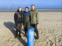
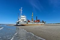
08/2022: Multi-level well installation
In two separate actions, three groundwater multi-level monitoring wells were installed on the DynaDeep investigation transect. At the end of May 2022, two multi-level wells were installed at the dune base and at the high-water line. In August 2022, the third multi-level well was installed at the mid-water line. A Harms drilling rig on a ship was used for this purpose.
The three multi-level wells, which are easy to spot with their blue pipes on Spiekeroog's northern beach, each consist of 4 groundwater wells filtered at depths of 6 m, 12 m, 18 m and 24 m below ground surface. This allows for depth-specific groundwater sampling. Furthermore, all groundwater monitoring wells are equipped with data loggers that continuously measure water level, electrical conductivity and water temperature.
The investigations at the groundwater monitoring wells are coordinated by Prof. Dr. Gudrun Massmann, DynaDeep subproject P1.
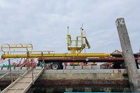
05/2022: SAMOS installation
The installation of the saltwater monitoring system "SAMOS" took place on 24.05.2022 at the northern beach of Spiekeroog. The 20 m long measuring system, developed by the Leibniz Institute for Applied Geophysics (LIAG), was installed vertically at the high water line at a depth of 1 to 21 m below the surface, supported by the drilling company Harms. The last electronic components were installed at the beginning of July 2022, after which regular measurements could start.
SAMOS measures the electrical conductivity over the entire vertical depth in intervals of 25 cm at two-day intervals, which provides information about the salinity of the groundwater and the location of the salt-freshwater interface. Furthermore, the temperature profile in the interval of 2 m is recorded simultaneously. The high-resolution SAMOS measurements contribute significantly to the investigation of the dynamic processes in DynaDeep. The SAMOS investigations are led by Prof. Dr. Mike Müller-Petke, DynaDeep subproject P1.
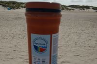
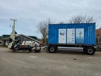
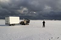
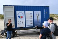
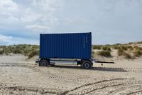
05/2022: Container delivery
The DynaDeep container was delivered to the dog beach and placed there at the foot of the dune on 20/05/2022. During the summer months, it will house the drilling device as well as further measuring instruments and other accessories of the researchers. In addition, the container will serve as an information point and provide information about the DynaDeep project. For this purpose, three information boards will be attached to the container in the near future. Planned beach walks, which are open to all interested parties and will be announced in the Spiekeroog event calendar, will also start at the container.
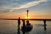
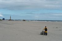
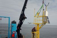
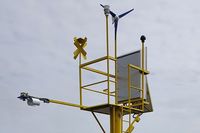
05/2022: Pole installation
The DynaDeep pole was installed on 05/05/2022 near the current low water line at the investigation transect. The installation could be carried out successfully on the seaward side with the help of a NLWKN vessel. The 7 m high pole accommodates a multitude of modern measuring instruments that continuously collect information on water levels, wave heights as well as temperature and salinity of the North Sea. Furthermore, an attached camera and a 3-D lidar system enable the accurate measurement of the surface morphology for the detection of beach redistribution. Weather information is continuously collected by a dedicated weather station.
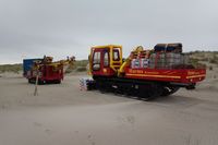
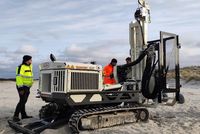
03/2022: Introduction drilling device
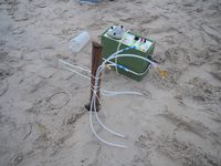
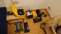
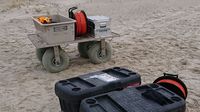
From March 29 to 31, technicians from the University of Oldenburg were instructed in the operation of the scientific drilling device specially acquired for the DynaDeep research group by the German Research Foundation.
This special device makes it possible to take water samples from depths of up to 25 m, which can then be analyzed for various environmental parameters in the laboratories of the participating institutes. In addition, a probe can be used to very quickly determine the salinity of the water over the entire depth profile.
With the help of the scientific drilling device, the subsurface at the study site at the "Hundestrand" will be investigated several times a year over the next two years to gain a better understanding of the beach ecosystem.
At the same time, DynaDeep scientists from the Leibniz Institute for Applied Geophysics in Hannover used geophysical methods to visualize the salt distribution in the subsurface from the surface down to a depth of 40 meters. The first result: a very clear thick layer of salt water, originating from the heavy storm surges of the past months, can be traced in the subsurface down to the base of the dune and overlays the fresh water flowing out of the freshwater lens below.
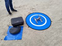
With the help of a drone, the height of the terrain surface was measured at the same time. Over the next few years, researchers at Kiel University will thus gain insights into the extent of sediment rearrangement and the resulting change in the beach. This so-called morphodynamics also affects the groundwater flow in the subsurface.
The scientists were amazed at how much the beach has shortened as a result of the storm surges compared to the fall. The low tide line is currently found at the level of the former high tide line. The area between the high and low tide lines, the so-called intertidal, is much steeper and narrower. Overall, the distance between the base of the dune and the low-water line has shortened by 50-100 m compared to the fall. Over the summer, it will then be possible to observe with the help of the drone how quickly a renewed accumulation of sand takes place.
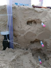
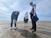
02/2022: Installation of lysimeters at the beach
With the dedicated effort of seven students of the Hermann-Lietz School on Spiekeroog, six lysimeters were installed on the northern beach of Spiekeroog under slightly adverse weather conditions. Lysimeters are plastic cylinders about 50 cm long that are buried in the beach at a depth of 80 cm. Infiltration water can enter the inside of the cylinder through a porous plate. The lysimeters were installed along the DynaDeep transect between the spring tide mark and the dune base. Based on periodic emptying of the lysimeters and measurement of the conductivity of the extracted water, infiltration rates during a storm surge can be quantified. The lysimeter studies, which will continue during the storm surge season, will be supervised on site by students from the Hermann Lietz-Schule.
See also the report on the webpage of the Hermann Lietz-Schule.
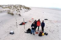
02/2022: Freshwater lens sampling campaign
Sampling of 14 fresh groundwater monitoring wells on Spiekeroog took place from 31/01/-04/02/2022. The wells screen the freshwater lens of Spiekeroog, i.e., the freshwater endmember to the Subterranean Estuary, at various locations in depth from 6 to 43 meter below mean sea level. Sampling was jointly carried out by subprojects P1, P3, P4 and P5.
Detailed analyses of the groundwater samples will help to better understand (i) sources and characteristics of organic matter, (ii) behaviour of trace metals and other dissolved ions and (iii) microbial community structures within the freshwater lens. The results will add to findings of previous sampling campaigns.
12/2021: Begin of geophysical campaigns
After a test campaign in summer 2021, the first regular geophysical campaign by subproject P1 took place on a beach transect on Spiekeroog in the period 06/12/-09/12/2021. The transect extends from the dune base over the upper beach into the intertidal zone. To record the temporal-spatial change of the salt distribution in the subsurface of the beach, Electrical Resistivity Tomography (ERT) measurements will be carried out continuously in a rhythm of about six weeks. In addition, the topography at the time of each ERT measurement will be recorded by differential GPS measurements.
Starting in spring 2022, the recurring geophysical measurements will be supplemented by pore water sampling using direct-push techniques and a vertical electrode array ("SAMOS") installed in the beach. This multidisciplinary approach will provide for the first time a temporally and spatially highly resolved view of the salt distribution in the subsurface of a high-energy beach.
10/2021: DynaDeep Kick-Off
In addition to the regular online webinars and virtual meetings, all project partners got to know each other for the first time at the DynaDeep Kick-Off at ICBM, Oldenburg, on 14/10/2021, when Corona numbers were low.
Short presentations of the subprojects with subsequent discussion as well as a personal introduction of all project partners were part of the program. The professional and personal exchange during breaks rounded off the event successfully.
07/2021: Test campaign beach morphology and geophysics
From 21/07/-22/07/2021 the first field campaign in DynaDeep took place. The goal of the subprojects P1 and PZ was on the one hand to record the highly dynamic beach morphology at a time during summer. This was done by differential GPS as well as an automated drone survey.
Furthermore, initial Electrical Resistivity Tomography (ERT) measurements were conducted to more accurately determine the saltwater/freshwater distribution in the subsurface. The results of the geophysical surveys will be used, among other things, to compare the salt distribution generated in model simulations with real field data.