News

  • Next meeting: Jour Fixe 09.02.2024
  • Next field campaign: 04.03-07.03.2024

Contact (Spokesperson)

Prof. Dr. Gudrun Massmann
Carl von Ossietzky University of Oldenburg

Funding and duration

Funding: German Research Foundation (DFG)
Duration (1st Phase): 01.04.2021 -31.03.2025

"Subterranean estuary observatory"

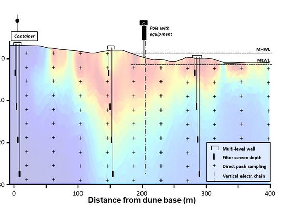
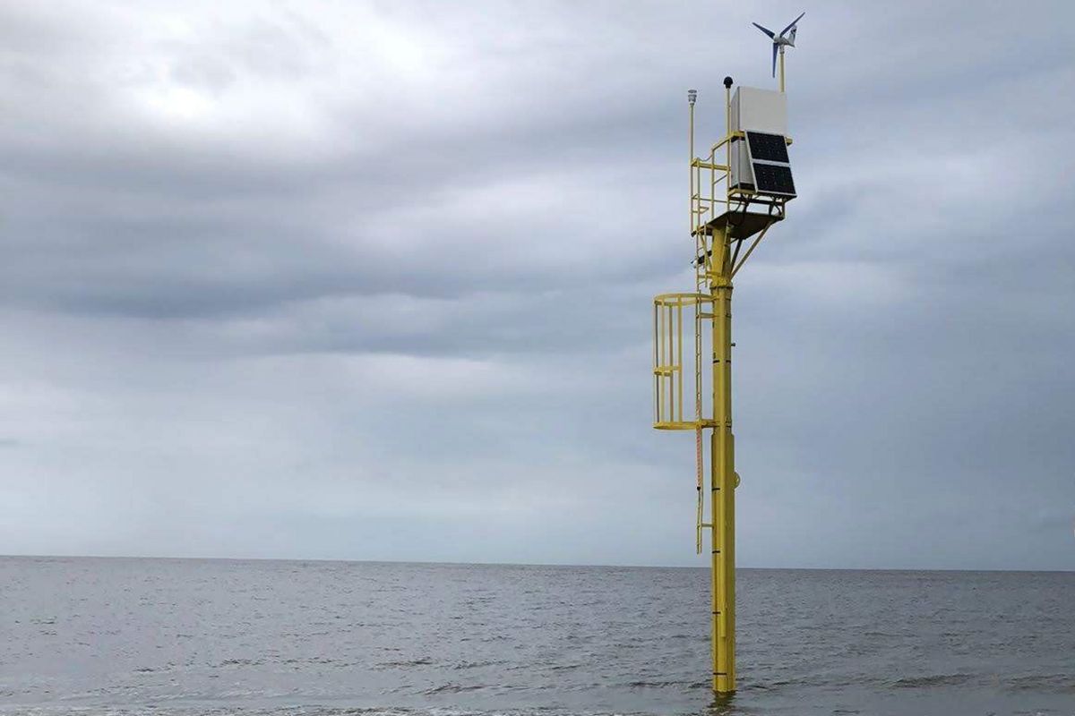
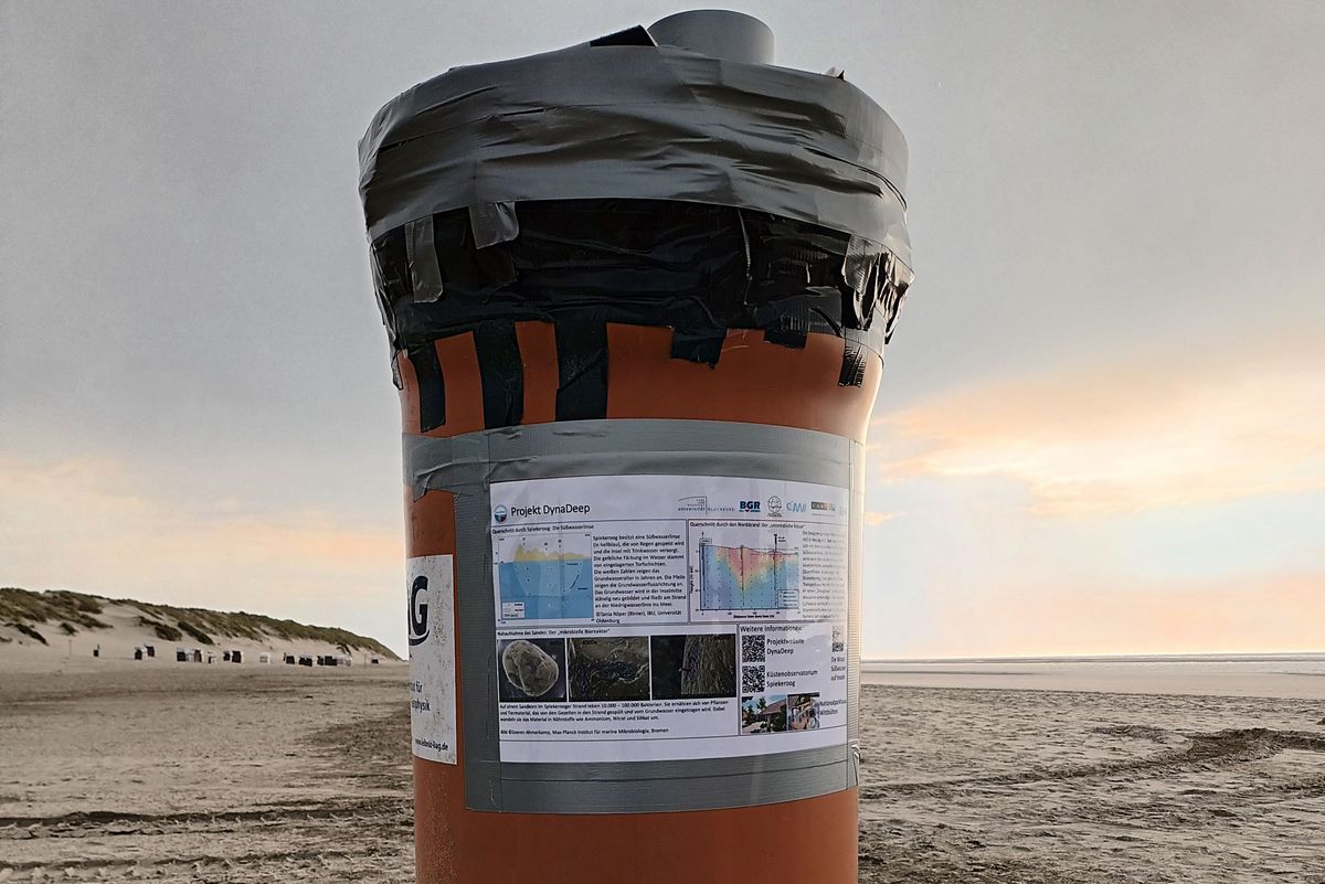
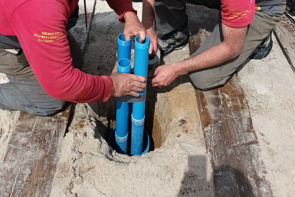
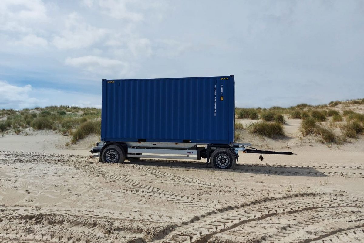
Within DynaDeep a dense sampling and monitoring network has been installed at the beach of Spiekeroog. It covers the entire subterranean estuary (STE) down to the saltwater wedge and is capable of withstanding storm surges, thus creating a unique Subterranean estuary observatory (see conceptual figure below). The observatory consists of several elements, as presented in the following.

Pole

The most striking element of the DynaDeep measuring field is a 7 m high pole located in the intertidal zone. With the help of a camera mounted on the pole, in combination with drones and 3-D lidar measurements, the beach morphology is recorded with high spatial and temporal precision. In addition, a wave recorder provides pressure and temperature measurements of the North Sea, whereby water levels and wave heights are continuously determined. Furthermore, weather information is continuously collected by the pole. Measurements of the pole are supervised by subproject P1 under the direction of Prof. Dr. Christian Winter.

Unkorrected raw data from the pole for the last two days

Raw and uncorrected sea level and weather data for the last two days. The figure will be updated hourly. In the Sea level plot, observed and astronmical tide data of Wangerooge Nord are shown for comparison. The data can be downloaded from Pegel Online (www.pegelonline.wsv.de) and Bundesamt für Seeschifffahrt und Hydrographie (www.bsh.de), respectively.


Drilling device

With the help of a Direct Push drilling device, water samples are taken at regular intervals from depths of up to 25 m, and continuous depth profiles of electrical conductivity - and thus groundwater salinity - are obtained. Compared to permanently installed groundwater monitoring wells, the drilling device enables depth-differentiated sampling that is flexible in space. The direct push vertical soundings in combination with ground-based hydrogeophysics thus allow the temporal and spatial localization of the dynamic saltwater-freshwater interface in the subsurface. Furthermore, depth-differentiated sediment samples can be obtained with the drilling device. Water and sediment samples are subsequently analyzed for various environmental parameters in the laboratories of the participating institutes. The measurements with the direct push drilling device are supervised by subproject PZ under the direction of Prof. Dr. Gudrun Massmann and Prof. Dr. Oliver Zielinski. The groundwater sampling is carried out in cooperation of all subprojects.

Saltwater monitoring system

The saltwater monitoring system "SAMOS" developed by the Leibniz Institute for Applied Geophysics (LIAG) continuously measures the electrical conductivity in the subsurface at the high water line by means of a 20 m long vertical electrode chain. The measurements allow depth-differentiated investigation of the salinity of the groundwater and thus provide information on the location of the saltwater-freshwater interface. The SAMOS investigations are supervised by subproject P1 under the direction of Prof. Dr. Mike Müller-Petke.

Observation wells

Three multi-level observation well nests were installed on the beach for regular groundwater sampling and continuous measurement of groundwater levels, salinities and temperatures. Each multi-level observation well nest consists of four separate observation wells, each of which screens the aquifer at a certain depth in the subsurface. Extracted groundwater is analyzed for water constituents relevant to the project. These include environmental tracers (P1), redox indicators and dissolved organic matter (P2, P3), trace elements and metal isotopes (P4), and microbial proxies and key-organisms (P5). The physicochemical parameters of pressure, temperature, and electrical conductivity are recorded with high temporal resolution using data loggers. The observation wells are supervised by subproject P1 led by Prof. Dr. Gudrun Massmann and subproject PZ led by Prof. Dr. Gudrun Massmann and Prof. Dr. Oliver Zielinski. The groundwater sampling is carried out in cooperation of all subprojects.

Beach container

The DynaDeep beach container is located at the foot of the dune. During the summer months, the container is primarily used as an equipment depot - among other things for the mobile drilling device. Furthermore, the container offers space for simple laboratory activities. The outside of the container is covered with information boards, which inform the interested public about DynaDeep and the field work. In addition, the conainer serves as a meeting point for the "beach walks" that accompany the field campaigns, led by a researcher. Installation and maintenance of the beach container is carried out by subproject PZ under the direction of Prof. Dr. Gudrun Massmann and Prof. Dr. Oliver Zielinski.

(Changed: 06 Feb 2024)  | 
Zum Seitananfang scrollen Scroll to the top of the page