STREMP (finished)
Spatial and Temporal Resolution Limits for Regional Mass Transport and Mass Distribution (STREMP)
The study estimates the regional mass transport and mass distribution in the Mediterranean and Black Sea catchments. Main topics are the coupling of continental hydrology with oceanography in coastal oceans and the water balance closure at the straits. It is based on a combination of altimetry, oceanography, hydrology and GRACE gravity fields. The Gravity Recovery and Climate Experiment (GRACE) mission provides measurements of the time-variable Earth gravity field. Combined with simultaneous and complementary observations and model results, it enables to globally and locally quantify interactions between atmosphere, hydrosphere and geosphere. On land, it provides the change in terrestrial water storage and allows in hydrography to estimate the evapotraspiration from the terrestrial water. On sea, combined with satellite radar altimetry observations it provides the change in ocean water mass. Satellite radar altimetry observes the total sea level variability, including both steric variations, due to temperature and salinity changes, and non-steric mass variations. The mass related (i.e. eustatic) sea level change is evaluated from the steric-corrected measurements. The GRACE derived time-variable mass change will be regionally compared to estimates of non-steric sea level change from altimeter observations. Environmental corrections for altimetry and GRACE data will be assessed and homogenized for the comparison of gravimetric and altimetric signals. An ocean general circulation model with a high spatial resolution and realistic forcing will be applied to the Mediterranean-Black Sea region and run both with and without assimilation of altimeter data. It wil simulate steric and salinity contributions, flow and water mass characteristics and aims at an improved understanding of the basic physical controls. Finally, we will quantify the importance of using GRACE and later GOCE data regionally in areas dominated by continental shelf and steep topography breaks.
The region selected for the project includes both an ocean area, the couple of lagoon type (Mediterranean Sea) and estuarine (Black Sea) basins, and a land area, their corresponding watersheds.
Mediterranean Sea
The general circulation of the Mediterranean Sea is determined by the density gradients between the Atlantic and Mediterranean waters, by the air-sea interaction and by a strong mesoscale activity of eddies. The bottom topography controls the exchange of water between the Atlantic Ocean and the Mediterranean Sea, and between the Western and the Eastern Mediterranean. The Mediterranean Sea is very sensitive to changes in atmospheric forcing. The exchange with the Atlantic Ocean is governed by the high evaporation in the Mediterranean. The river runoff R is a small contribution to the Mediterranean freshwater budget (evaporation minus precipitation minus runoff (E-P-R)) and is comparable to E-P in spring.
Black Sea
The basic dynamical feature in the Black Sea is a cyclonic rim current with numerous mesoscale eddies near to the coast The general circulation seasonal variations are mainly wind-driven. Most of the seasonal mass change is due to the river runoff. The annual amplitude of the thermo-steric heights in the Black Sea is 2 cm. The Black Sea basin is sensitive to climate variability and amplifies large scale climatic signals by integrating the variations of global forcing over a vast catchment area. Evaporation exceeds precipitation and the freshwater budget (E-P-R) assumes both positive and negative values because of the river runoff. Its watershed is 5 times the area of the Black Sea itself (24 x 105 km2). The annual discharge of its biggest rivers (Danube, Dniepr, Dniestr, Southern Bug, Don and Kuban) is of the same order of magnitude of the discharge in the Mediterranean Sea. The sea level is subject to great seasonal, inter-annual and decadal variability and is the most important parameter controlling the exchange with the Mediterranean Sea.
Involved Institutes
- Institute for Physical Geodesy, Technical University Darmstadt
- Delft Institute for Earth Observation and Space Systems, Faculty of Aerospace Engineering, TU Delft
- Physical Oceanography, Institute for Chemistry and Biology of the Sea (ICBM), University of Oldenburg.
Ocean & Ocean freshwater budget (ICBM)
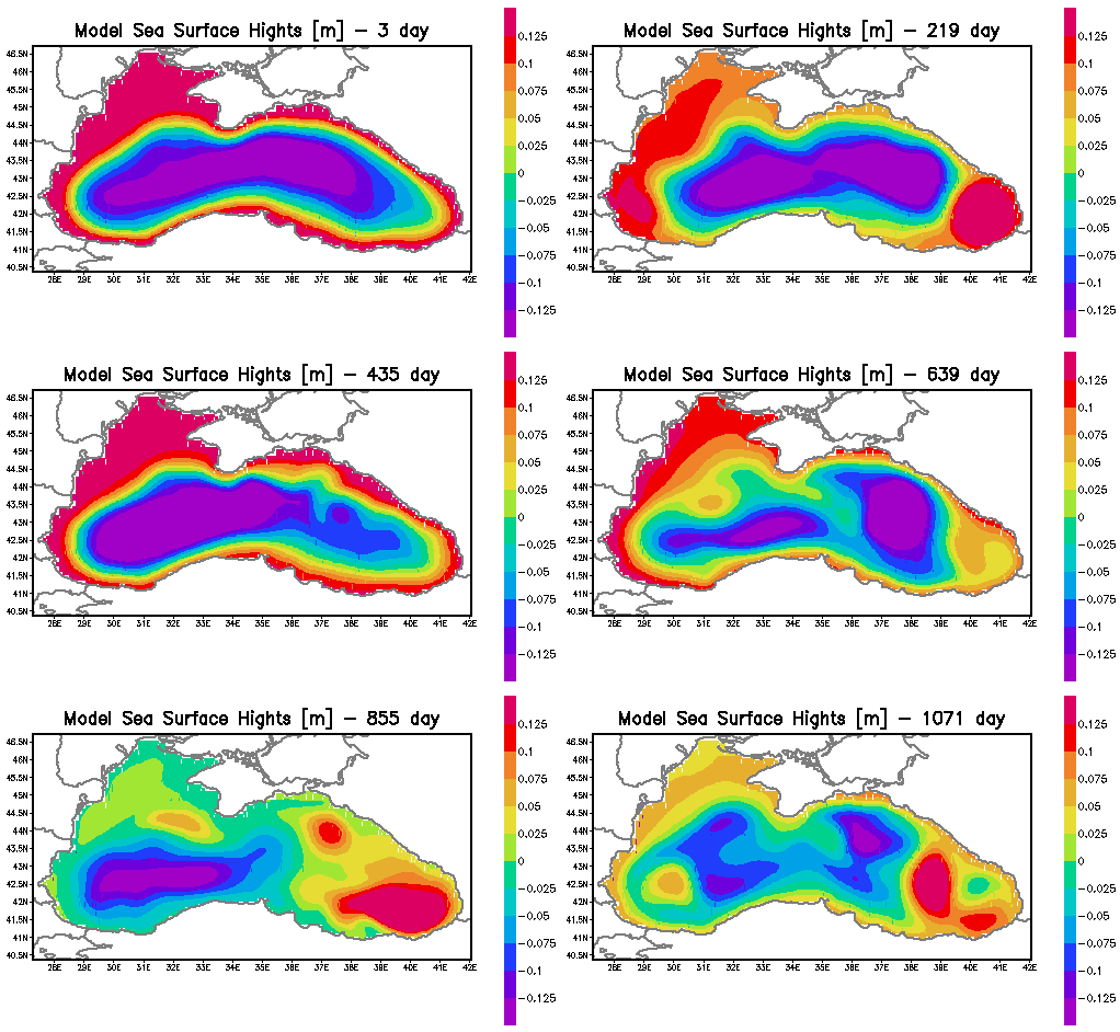
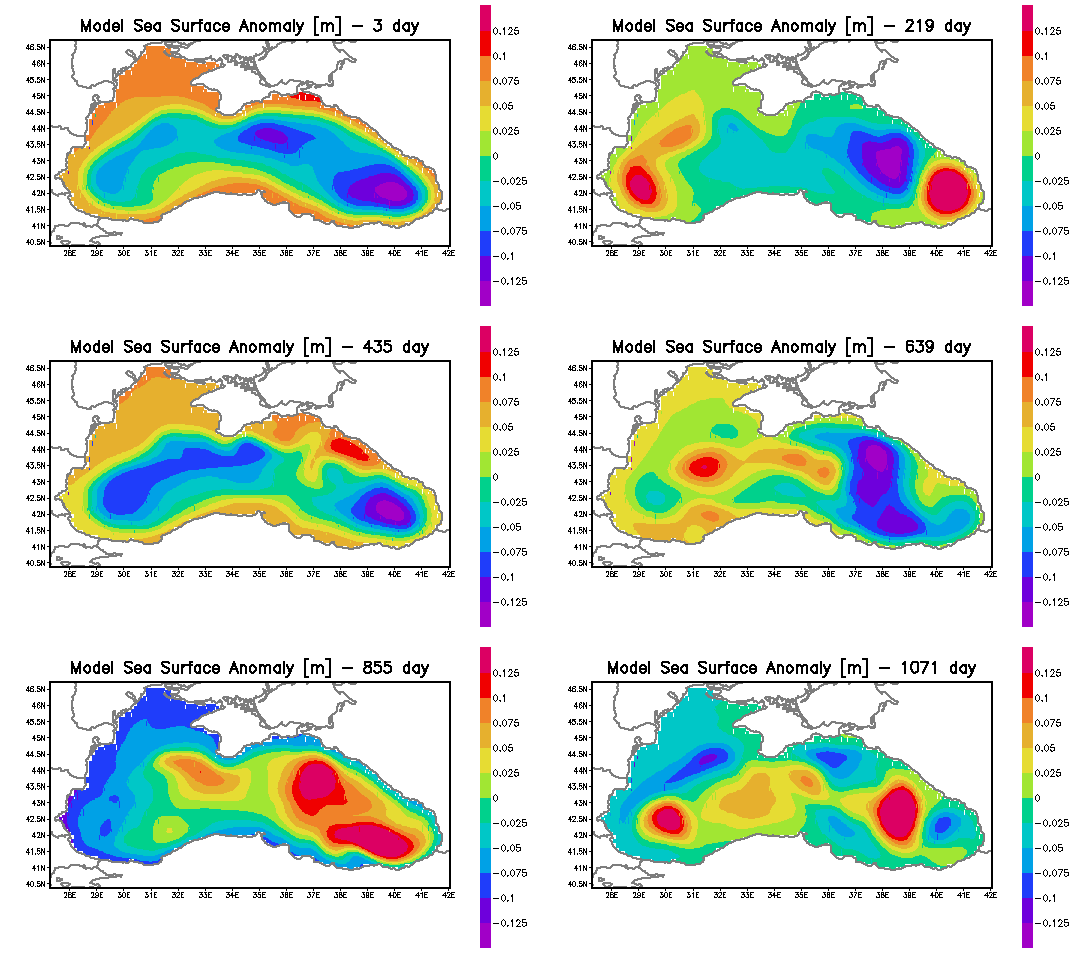
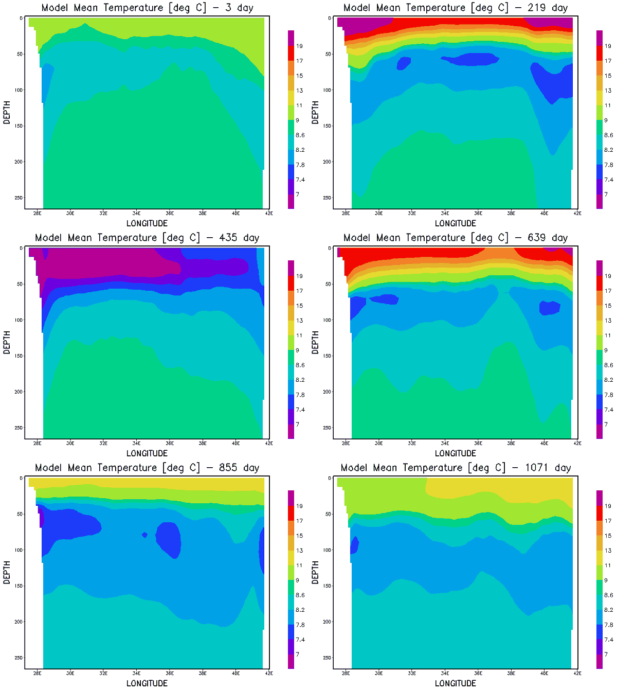
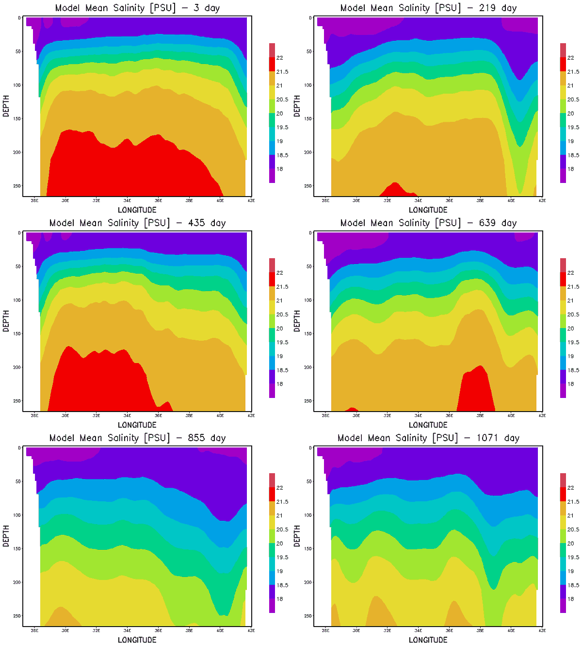
The steric sea level component is estimated from temperature and salinity data outputs from the ocean models (MFSTEP in the Mediterranean and local model in Black Sea from this task). The accuracy of the steric component is fundamental for mass change estimation from altimetry data and is checked by using different temperature and salinity model outputs and against local data. Data outputs with sufficient resolution of basic physical processes are stored, prepared in a suitable form and made available to partners for further analysis. The approaches used to process data are coherent with the ones of ongoing activities in Europe (e.g. MERSEA, MFSTEP).
- Prepare temperature and salinity fields for Mediterranean Sea (MFSTEP) and for Black Sea (preliminary model)
- Prepare sea level heights for Mediterranean Sea (MFSTEP) and for Black Sea (preliminary model)
- Perform simulation with high resultion Black Sea Ocean model
- Evaluate steric heights from temperature and salinity data and from ocean model output
- Validate temperature and salinity fields from the model against climatology and SST from remote sensing
- Collect, analyse and assimilate precipitation, evaporation and runoff data
- Check consistency of the model
For questions, please contact sebastian.grayek@uol.de Sebastian Grayek

![[Translate to English:]](/f/5/_processed_/3/2/csm_ICBM-Logo-transparent-_91fe1c6774.png)


